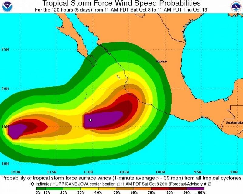
Hurricane Jova packs 120 mph winds
This projection shows the tropical storm force wind speed probabilities.
October 10, 2011
Emergency officials scrambled to open shelters as Jova rapidly strengthened off Mexico’s Pacific coast early Monday, becoming a major hurricane with 120 mph winds, forecasters said.
Mexican authorities described the storm as a “great danger” and warned that the hurricane could intensify before it makes landfall Tuesday.
The Category 3 storm was about 255 miles southwest of the resort town of Manzanillo, Fla. at 8 a.m. ET, according to the National Hurricane Center in Miami. It was moving east at about 6 mph.
A hurricane watch is in effect from Punta San Telmo north to Cabo Corrientes, near Puerto Vallarta, Mexico.
“Our main concern is the welfare of the population,” said Trinidad Lopez, civil protection director in Jalisco state. “We’re doing everything in our power to protect people.”
At least 100 shelters were open Sunday for people who could be affected by the storm, Lopez said. Food, cots and blankets have been distributed, he said.
Crews positioned heavy machinery in strategic locations throughout the state, Lopez said.
Mexico’s federal government is providing assistance as well. More than 300 soldiers have been deployed and members of the Mexican navy in Puerto Vallarta are on alert, Lopez said.
A tropical storm watch also is in effect in an area near Punta San Telmo, stretching south toward Lazaro Cardenas.
Mexico’s National Meteorological Service warned boaters off the country’s Pacific coast to prepare for increasing rains, waves and winds.
High surf warnings are also in effect, with forecasters warning swells will strike Mexico’s southwest coast later in the day Monday.
“These swells are likely to cause life-threatening surf and rip current conditions,” the hurricane center said. “Jova is expected to produce total rain accumulations of 5 to 10 inches over the states of Michoacan, Colima and Jalisco, with isolated maximum amounts of 15 inches possible.”


