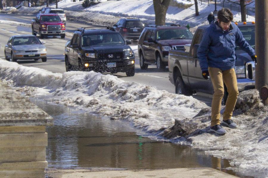
Flood potential in Ames area
Kennedy DeRaedt/Iowa State Daily
Freshman in software engineering Matthew Medley avoids the flooded sidewalk in front of the Memorial Union on Lincoln Way on Sunday. Warmer temperatures, rainfall and the melting snow are causing flooding in certain parts of Ames.
March 10, 2019
While many Ames residents are looking forward to the rising temperatures, snow and frost left over from multiple record-setting snowfalls could melt away causing substantial flooding in Ames.
The buildup of snow and the sudden switch in weather patterns has already caused the pooling of water around Ames, and it is likely to continue. The bitter cold weather that resulted in the first cancellation of classes in several years set records for low temperatures across the state, and records were set for the amount of snowfall central Iowa received since the start of the year.
The National Weather Service forecasts Ames will have temperatures consistently at or above freezing the next week, providing an opportunity for the snow piles scattered throughout Ames to melt.
When snow starts to melt in grand proportions, drainage systems are overwhelmed by the sheer amount of water and the excess does not drain quickly, resulting in flooding. The change in weather is not unusual, however.
“Snow melt is obviously a spring occurrence, what happens is we get all these warmer temperatures and all that snow begins to melt around that area,” said Jacob Vos, senior in meteorology and journalism and mass communication and the man behind social media account ISU Weather’s daily forecasts.
According to the National Weather Service, the Ames area had roughly 2 to 3.9 inches of snow on the ground as of Friday. In other words, the amount of snow on the ground, if melted instantaneously, would be equivalent to 2 to 3.9 inches of water.
While a few inches of water typically wouldn’t cause flooding, recent frost levels are deep enough that the soil can not absorb excess water.
“This is very common during the spring, because we still have our ground frozen,” Vos said. “Like on central campus where you get those huge puddles sometimes during the spring where it even covers the sidewalk.”
Susan Gwiasda, public relations officer for the city of Ames, said the city is always monitoring the weather, police are constantly out on the roads and reporting on potential flood conditions, and the water plant has people watching water levels 24 hours a day.
The city of Ames has a webpage for their flood watch program where water level conditions can be viewed.
Nothing can be done to prevent flooding, but Gwiasda said residents who see storm drains that are blocked are encouraged to clear them to help mitigate the potential for flooding to occur on streets.
The upcoming possibility for flooding in Ames is not a rare occurrence. Last summer, Stuart Smith Park and other low-lying areas in Ames were affected by flash floods as a result of heavy rains, with more than five inches of rain falling on the morning of June 14.
Gwiasda said they refer to this as pooling and ponding and in these cases they just wait until it dissipates.


