Karstens presents tornado research, emphasizes danger of storms

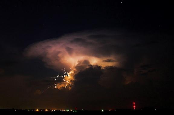
Courtesy photo: Rachel Gardner/Flickr
Thunderstorms require three factors in order to form — convective (or unstable) air, moisture and updraft/downdraft caused by a warm front rapidly rising over a cold front.
April 2, 2012
Christopher D. Karstens, an ISU graduate in geological and atmospheric sciences, gave a lecture Monday about geospatial analysis of tornado-induced forest damage from aerial photography.
Karstens studied tornadoes by their tree-falling pattern and the amount of damages done to tornadoes going down a path. He mostly looked at two major tornadoes: the one in Joplin, Mo., on May 22, 2011, and the one from Tuscaloosa to Birmingham, Ala., on April 27, 2011.
Karstens designed a chart showing the speed, width and where he thought the residential damage was: for example, roofs blown off and exterior walls collapsing. He said he deducted this from digitalized aerial photos.
To help, he built a three-dimensional terrain model. The model was 32 feet long and 20 feet wide.
“It took me about two months to make, but it helped a lot with my research,” Karstens said.
Karstens calculated exactly how many trees fell in both tornadoes and made a computerized map of the tornados travel path with the marked trees. His research, he said, was very strategic and complicated.
“I am not insane, but I am a grad student,” Karstens said.
Karstens said he wanted to make a software module that meteorologists could use for the tornado’s path and to know the width of the tornado.
“But it turns out that already exists, but I want to have a module that would help with the tree analysis,” Karstens said.
With his research and damage surveys, he actually visited the sites where he found out that there were large amounts of damage spreading way beyond where the tornado actually touched.
“Just because you’re not in the tornado doesn’t mean you can’t be hurt or your property can’t get severely damaged,” Karstens said.
Depending on a tornado’s strength, the winds can cause damage many miles away.


