Geodesign techniques for sustainable development
Alexandra Kelly/Iowa State Daily
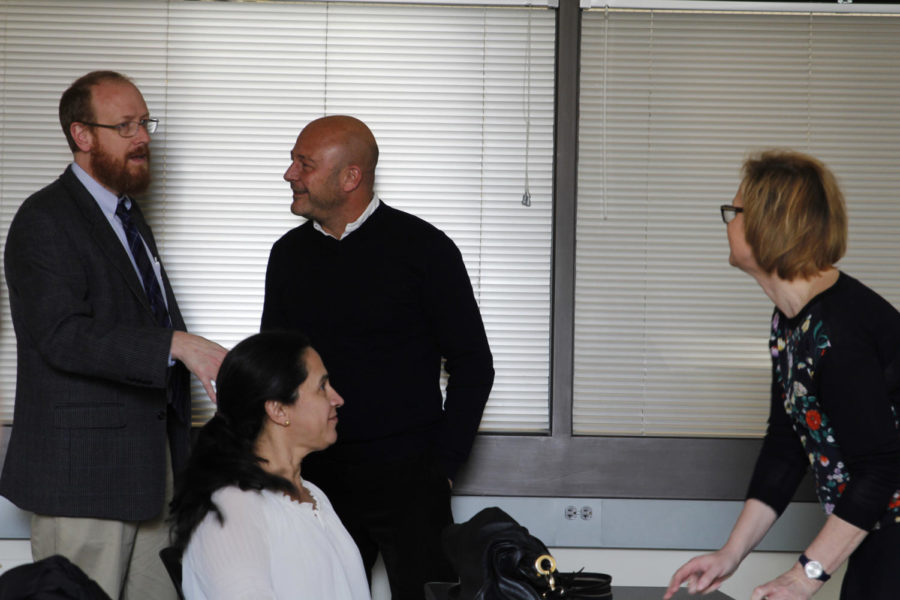
Michele Campagna speaks with colleagues before the lecture. Campagna, Associate professor of spatial planning at the University of Cagliari, Italy, spoke about the importance of sustainable planning and design. Campagna stressed the strong need for new methods and approaches in the furthering years. The lecture was held on April 11 in the Design Building.
April 11, 2017
In the 21st century, designers are focusing more on building around geographic information and the natural world.
Sustainable design and development techniques were at the forefront of Michele Campagna’s, associate professor of spatial planning at the University of Cagliari, Italy, lecture Tuesday in a packed College of Design room. Geodesign, an integrated process of planning and building around natural environments, was the key technique Campagna discussed during his lecture.
As an associate professor, Campagna’s work focuses on metaplanning, geodesign, strategic environmental assessment and the scientific method in planning. He also is a scientific coordinator of the UrbanGIS lab. The lab focuses on applying spatial information science methods and tools to spatial planning, environmental impact assessment and territorial governance.
Geographic information science is an integral part in the designs that Campagna focuses on as he attempts to design infrastructure that closely follows natural systems.
With sustainable design, Campagna pays attention to the integration of natural geographic elements with man-made designs. The protection of the natural anthropogenic environment is webbed into Campagna’s work in improving the quality of life in communities.
The Strategic Environmental Assessment, a systematic decision support process aiming to ensure that environmental and possibly other sustainability aspects are considered effectively in policy, plan and program making, is applied to all regional, urban, local, land-use, landscape and sector planning.
“[The SEA] should start at the very beginning of the planning process,” Campagna said. “… Consideration of the assessment of the impact should be done starting at the beginning to inform the project or the design.”
When designing Campagna stresses involving the public in the design process as well as having more than one design prepared for the project.
“Anytime we ever have a project that may impact the environment we should inform the community and get feedback,” Campagna said.
However, with current SEA practices, there happens to be issues.
There are no informed alternatives, difficulties in quantitative impact assessment, difficulties in public involvement and participation and the wrong focus on data not on design decisions.
Campagna referenced the book “Microcomputers in Urban Planning and Management” by Richard K Brail as something he uses when planning for a design. “Expert Systems: Applications to Urban Planning” is also a book he suggests when using computer programs to solve issues that planners face in their design processes.
“If we look at our design related to other components … physical environment, anthropogenic environments or air, soil, air, fauna, flora, and then the community, we should not only evaluate the impact after the design is done but we should start from the beginning and inform the design-making process,” Campagna said.
When planning a design for a desired location, Campagna can also use social media geographic information, SMGI, to notice how people interact with a space. Instagram, YouTube, Twitter, etc., can be evaluated to consider the usage of a particular region. This could come into play as a designer focuses on integrating new spaces for tourism activities, Campagna said.
“I believe that geodesign can address some of the most urgent challenges for innovation and sustainable development,” Campagna said.
Jamison Brus, junior in pre-community and regional planning, attended the lecture to learn more about GIS as he’s currently taking the CRP 251X “Introduction to Geographic Information Systems” class and plans on minoring in GIS.
“I think geodesign is going to continue to innovate and I think it’s really going to change what GIS is,” Brus said. “… I think it’s going to be more implemented in the line of practice, which is why I want to get into that now because I think it’s going to be really, really important for the future.”