- App Content
- App Content / News
- News
- News / Politics And Administration
- News / Politics And Administration / City
A closer look at the recently adopted Lincoln Way Corridor Plan
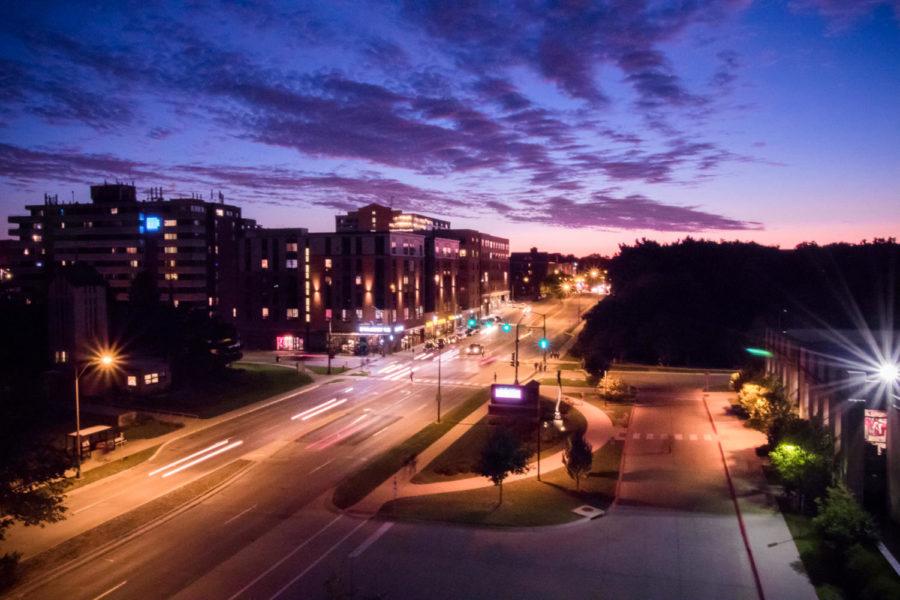
Students and Ames community members may experience changes to Lincoln Way in the coming future.
April 12, 2017
The city of Ames may be seeing major changes on and around the entirety of Lincoln Way in the near future.
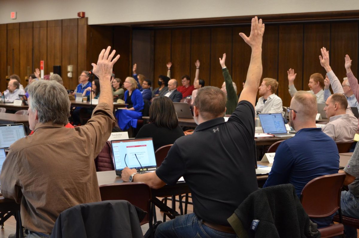
During Tuesday’s city council meeting, the council adopted a resolution making a newly developed Lincoln Way Corridor Plan an advisory document for future development.
The plan, which has been in the works for more than a year, sets guidelines on the development of properties along Lincoln Way. The plan was developed by consulting firm Houseal and Lavigne.
Council member Tim Gartin said the ideas to create a plan came from the idea that Lincoln is an integral part of Ames.
“Lincoln Way has long been seen as a major thoroughfare in Ames that needs some help,” Gartin said.
Aesthetic, safety and functionality issues were recognized along Lincoln Way. There is also a recognized need for Lincoln Way to act as a connecting point between various parts of Ames as a whole.
During Tuesday’s meeting, the council debated parts of the plan and agreed to adopt it as an advisory document.
“It functions as a document which advises us on what we might do, but it’s not binding on anything,” Gartin said.
Public input will be a large part throughout the process of adopting the plan. Council member Bronwyn Beatty-Hansen said she would be receptive to public opinion during the process.
“I’m always sensitive to input from the public,” Beatty-Hansen said. “If there is a huge public outcry, I would certainly consider that before plowing ahead with any changes.”
Gartin also said that the plan could see many changes before being fully implemented.
“We don’t start a process like this assuming the first draft is the last draft,” Gartin said.
The resolution allows individuals to directly propose land use policy plan amendments and rezoning for properties that are consistent with the plan.
Requests then go through the public hearing process to determine consistency with city policies.
The plan, large in scope, could take up to 15 years to fully implement and is expected to act as an advisory document for future councils as well. The public will also have opportunities to comment on various parts of the plan.
Although the ambitious plan could take time to implement, both Gartin and Beatty-Hansen believe there are certain “low hanging fruit” that could put changes into place soon, namely landscaping and lighting improvements.
The plan itself consists of two parts: a framework plan and individual focus areas.
The framework plan is a broad overview of the initiative that identifies overall principles. It is intended to guide overall strategies to improve the corridor and connect it.
Looking at the framework itself, the plan aims to use Lincoln Way as a type of “backbone” to tie the individual parts of Ames together.
The framework also acknowledges the diversity of the Ames community and differences in transportation needs. The plan suggests that the Lincoln Way corridor must work as a transportation system that supports pedestrians, bicycles, bus riders and vehicles.
The framework then identifies six key districts along Lincoln Way and the ideal uses for each area.
The first area is the West Gateway district, which extends from the western edge of the city east to Dakota Avenue.
In the West Gateway, the plan recommends looking at a variety of residential densities, commercial uses at intersections and larger developments due to unused land.
Multi-modal transportation is also a focus in the West Gateway. The plan asks the city to look at extending existing multi-use paths and improving intersections for bikes and pedestrians.
Moving east is the West Side Mixed-Use District, from Dakota Avenue to the start of Campustown.
For this area, the focus seems to be on increasing population density. Focus is on area around West Hy-Vee, where the plan hopes to “sustain an active commercial environment.”
Further east is the Campustown District, which consists of Campustown to University Boulevard.
The first focus is looking at a Campustown transition area, which looks at attached residential housing and the current development on Lincoln’s 2700 block.
The plan also suggests redeveloping over the current Dunkin’ Donuts to create a street level commercial area with upper-level residents.
The plan includes measures to increase the availability of bike paths south of Lincoln Way as well.
To the east of Campustown is the Oak-Riverside District. The part of the plan in this section that has generated the most controversy is the “road diet.”
The road diet would turn Lincoln Way, once over Squaw Creek, from a four-lane to a two-way highway with a center turning lane.
The hope of this road diet is to address the rising amount of traffic on Lincoln Way by encouraging multi-modal transportation.
East of Oak-Riverside is the City Center District. City staff has stated that the top priority for the city is to work on the Downtown Gateway focus area, which exists in the City Center District and may be seeing the changes soonest.
Interesting changes coming to this area exist in what is called “character corridors.” The idea has been for this area just south of downtown to act like a complementary area to downtown Ames.
These corridors, which would exist on Kellogg Street and Duff Avenue, would act as primary points of entry to downtown Ames.
Gartin thinks the developments near Kellogg Street will play a “huge role” in the future of Ames.
“In the next couple years I think you’ll see some huge development in downtown Ames,” Gartin said.
Beatty-Hansen, however, feels developments in the area could take longer because of the current structure of the area. There are many small businesses in the area, and it could take time to consolidate property to start larger developments.
The area around the intersection of Kellogg Street and Lincoln Way looks to be seeing the most development. Although there are multiple alternatives included in the plan, certain key points are consistent.
The plan calls for a hotel and entertainment complex in the area. The focus beyond that is a mix of office space and commercial properties in the area.
North of Lincoln would also potentially see a plaza-like area and a greater focus on pedestrian over vehicular mobility.
With expanded shopping, a hotel and office space, a parking structure could also be an addition to the area.
Lincoln Way east of Duff is called the East Side Employment District. This side of Ames would see significant improvements to bicycle transportation, including a bike lane on Lincoln.
Development is not a main priority in this area of Ames. Rather, increasing functionality for existing occupants is what is being looked at.
Gartin feels that the fact that Ames is having conversations like these to improve quality of life in Ames is a positive sign for the future of the city.
He said development is happening in Ames while other cities of similar size are “struggling to keep lights on.”
“We don’t take anything for granted,” Gartin said. “We work very hard every day to make Ames the type of place where you want to start a business, raise a family and retire.”